New: AI-built dashboards you can share with one link. See what shipped →

 ENGINE
Managed geospatial compute. One API call.
Process massive rasters, satellite imagery, and climate data at scale. Integrate the full power of GeoPilot into your applications via REST API, Python and JavaScript SDKs, or embeddable map components.
Tiled processing for multi-gigabyte rasters. Drone imagery, satellite scenes, LiDAR DEMs, and climate data.
Large rasters are split into tiles, processed in parallel, and seamlessly stitched back together.
Work with any number of bands. Calculate indices (NDVI, NDWI, SAVI), band math, and composite visualizations.
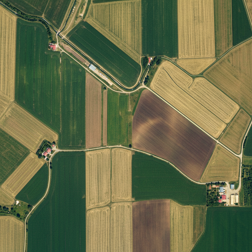
From 30m Landsat to 2cm drone imagery. Automatic reprojection and resampling.
Leverage GPU for convolutions, classification, and deep learning inference.
Process via API for programmatic access, or use cloud infrastructure for files up to 500 MB.
Zonal statistics, histograms, class area summaries, and auto-generated PDF reports.
The standard for geospatial rasters. Multi-band, tiled, compressed. Full COG (Cloud Optimized GeoTIFF) support.
Climate and oceanographic datasets. Multi-dimensional arrays with time series, elevation bands, and variable metadata.
High-compression satellite imagery. Sentinel-2, Landsat, and commercial satellite providers.
From precision agriculture to climate science, Engine handles it all.
Process centimeter-resolution orthomosaics from DJI, senseFly, and other drone platforms. NDVI, DTM generation, stockpile volume calculation, and change detection.
Typical: 2-20 GB per flight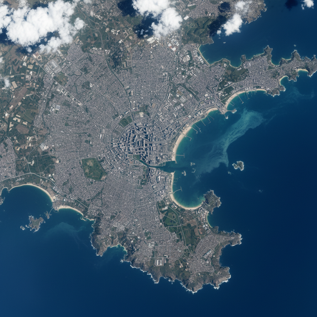
Analyze Sentinel-2, Landsat, MODIS, and commercial satellite imagery. Band math, spectral indices, classification, and time series analysis.
Typical: 500 MB - 5 GB per scene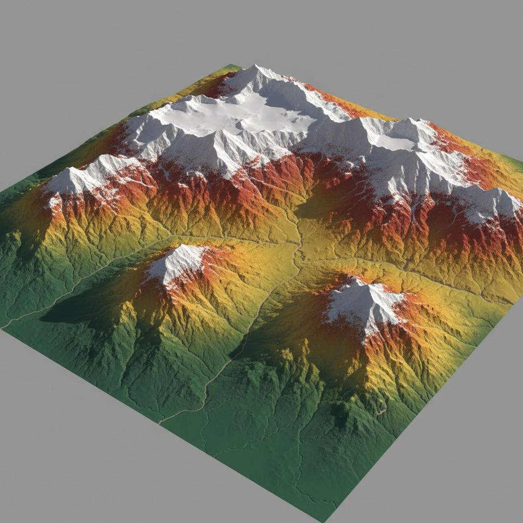
Process LiDAR DEMs, SRTM, ALOS, and Copernicus DEM data. Terrain analysis, viewshed, slope, aspect, curvature, and hydrological modeling.
Typical: 1-10 GB per tile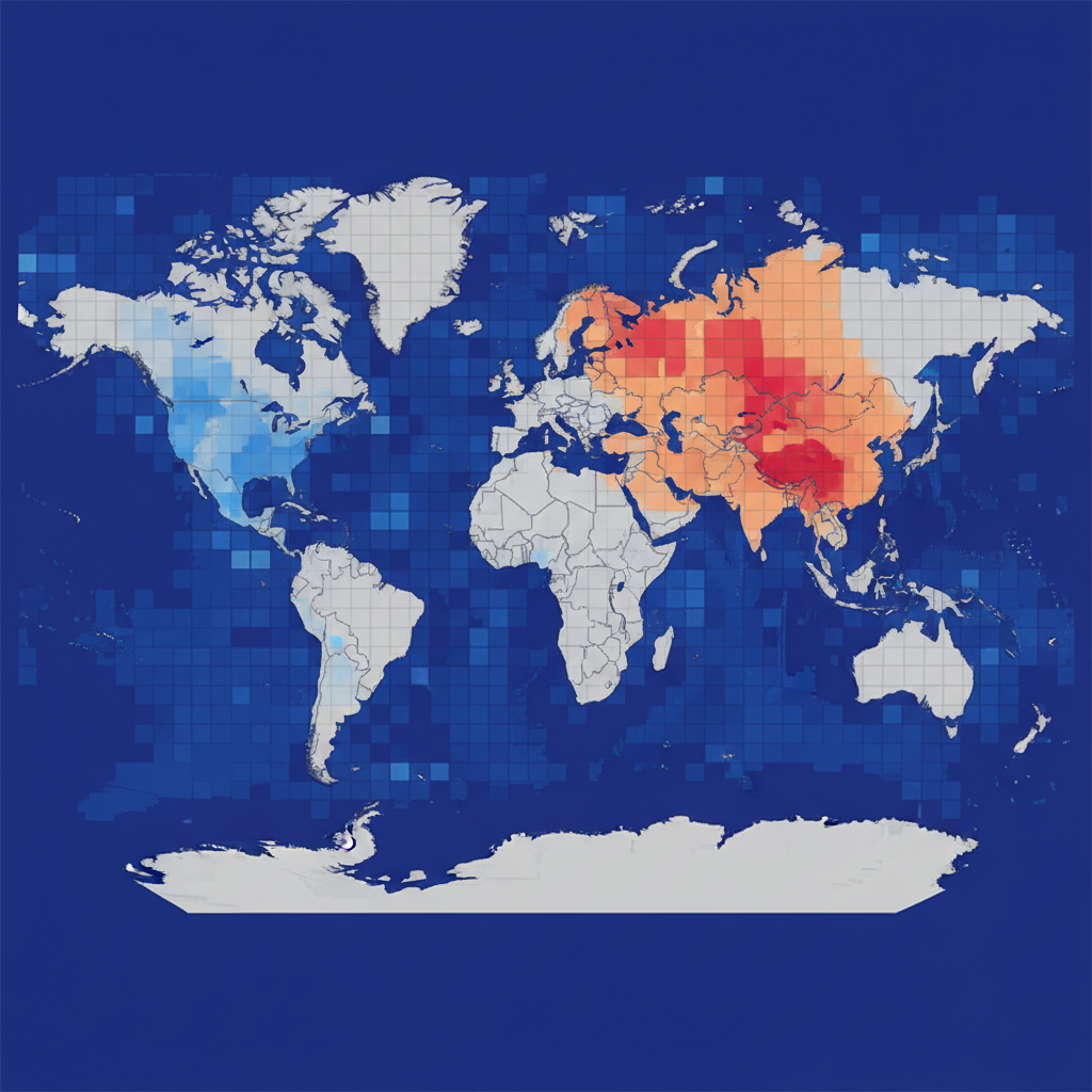
Analyze gridded climate data from ERA5, CHIRPS, GPM, and other sources. Temperature, precipitation, evapotranspiration time series and anomaly detection.
Typical: 100 MB - 50 GB per datasetPython and JavaScript SDKs, or use raw REST calls from any language.
from geopilot import GeoPilot

gp = GeoPilot(api_key="YOUR_KEY")

result = gp.analyze(
    geometry=my_polygon,
    operation="ndvi",
    date_range=["2026-01-01", "2026-03-01"]
)

print(result.summary)import { GeoPilot } from '@geopilot/sdk';
const gp = new GeoPilot({ apiKey: 'YOUR_KEY' });
const result = await gp.analyze({
geometry: myPolygon,
operation: 'ndvi',
dateRange: ['2026-01-01', '2026-03-01'],
});
console.log(result.summary);curl -X POST https://api.geopilotai.com/v1/analyze \
-H "Authorization: Bearer YOUR_API_KEY" \
-H "Content-Type: application/json" \
-d '{
"geometry": { "type": "Point", "coordinates": [77.59, 12.97] },
"operation": "ndvi",
"date_range": ["2026-01-01", "2026-03-01"]
}'{
"operation": "ndvi",
"mean": 0.42,
"min": 0.08,
"max": 0.76,
"area_km2": 12.4,
"date": "2026-02-15",
"format": "geojson",
"download_url": "https://api.geopilotai.com/..."
}Every operation available in GeoPilot Platform is accessible through the Engine API.
Run any GIS operation programmatically — buffer, overlay, intersection, zonal statistics, and 100+ more.
Process satellite imagery, compute spectral indices, run band math, and extract insights from any raster.
Compare satellite imagery between two dates. Get quantified change metrics for any area of interest.
Convert between geospatial formats — Shapefile, GeoJSON, KML, GeoTIFF, GeoPackage, and more.
Long-running analyses return results via webhook. No polling needed — get notified when done.
API key authentication, per-key rate limits, usage dashboards, and team management.
Vegetation and water spectral indices
Slope, aspect, curvature, TPI, TRI
Flow direction, accumulation, watersheds
Supervised and unsupervised classification
Trend detection, anomaly mapping
Statistics per zone, region, or polygon
Get your API key and start integrating geospatial intelligence into your product.
Request Access