New: AI-built dashboards you can share with one link. See what shipped →
Asset-level climate exposure, emissions roll-ups, and supply-chain geolocation.
Sustainability teams must report ESG metrics with spatial precision — facility exposure, supply-chain risk, scope-3 mapping. Vector overlays handle most of it; satellite-based monitoring stays on desktop.
Web · vector workflows
Drop your shapefiles, GeoJSON, or GeoPackage into the workspace and ask. No install, free forever tier, results in seconds.
Overlay facility points against published climate-risk polygon layers and score each on a 1–5 scale.
› Score every facility for flood, heat, and sea-level rise exposure on a 1–5 scale
Aggregate facility emissions into proportional symbol maps and choropleth dashboards.
› Proportional symbol map of CO2 emissions by facility; highlight top 10 emitters
Geocode supplier addresses, plot the network, and flag suppliers in high-risk zones.
› Geocode the supplier list and flag any supplier inside a flood or wildfire zone
Buffer protected areas, indigenous lands, and Ramsar sites; flag operations inside.
› List operations within 1km of a protected area or Ramsar site, with the polygon name
Intersect coastal assets with published sea-level rise polygon scenarios.
› For each coastal asset, list which sea-level scenarios (1m, 2m, 3m) inundate it
Desktop · raster image processing
The desktop app runs Python on your machine — no timeouts, no upload limits, works air-gapped. Request access to get the build that fits your OS and use case.
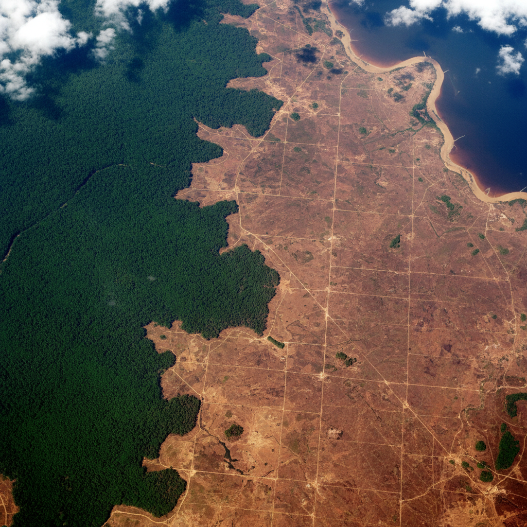
Run change-detection on multi-date satellite imagery to quantify forest cover loss in hectares.
Process Landsat thermal bands into LST rasters for urban-heat and operational-risk mapping.
Combine canopy-height rasters with allometric equations to estimate above-ground biomass per hectare.
One workspace
Start in the browser. Move to desktop when the dataset gets heavy. Projects sync — no re-importing, no re-prompting.
Describe the analysis. GeoPilot picks ops, runs them, returns map + data + report.
Buffers, joins, network analysis, choropleths — finishes in seconds, every plan.
Same chat continues against local Python. No timeouts, no upload caps.
Free vector tier. Desktop by request — tell us your OS, dataset size, and sensor type and we'll get back within one business day.